Logo Oapen
  • Search
  • Join
    • Deposit
    • For Librarians
    • For Publishers
    • For Researchers
    • Funders
    • Resources
    • OAPEN
    • For Librarians
    • For Publishers
    • For Researchers
    • Funders
    • Resources
    • OAPEN
    View Item 
    •   OAPEN Home
    • View Item
    •   OAPEN Home
    • View Item
    JavaScript is disabled for your browser. Some features of this site may not work without it.

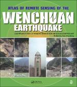
    Atlas of Remote Sensing of the Wenchuan Earthquake

    Proposal review

    Cas- Project Team of Remote Sensing for Wenchuan Earthquake

    Thumbnail
    Download PDF Viewer
    Author(s)
    Huadong, Guo
    Contributor(s)
    Britton, Irma (editor)
    Language
    English
    Show full item record
    Abstract
    In May 12, 2008, the Wenchuan County earthquake caused devastating loss of human life and property. Applying all the remote sensing technology available, the Chinese Academy of Sciences immediately launched into action, making full use of its state-of-the-art facilities, remote sensing planes, and satellites to amass invaluable optical and radar data. This unprecedented use of comprehensive remote sensing techniques provided accurate, up to the minute information for disaster management and has left us with a visually stunning and beautiful record that is as much a scientific achievement as it is an artistic one. Based on the accumulated data and images collected by the Project Team of Remote Sensing Monitoring and Assessment of the Wenchuan Earthquake, Atlas of Remote Sensing of the Wenchuan Earthquake documents the events as they happened in real time. The book covers the disaster from six aspects: geological, barrier lakes, collapsed buildings, damaged roads, destroyed farmland and forests, and demolished infrastructure. It also demonstrates that the Dujiangyan Irrigation Project, which has been standing for 2000 years, remains fully functioning, and keeps the Chengdu Plain operating optimally even after the earthquake. Translated into English for the first time, the Atlas presents a pictorial summation of this unique project. It chronicles the event with over 280 before and after color images from a range of perspectives. This volume dramatically demonstrates the value of remote sensing for understanding how an earthquake unfolds and the potential of remote sensing in helping coordinate emergency relief. A pictorial record of events as they unfolded, this book provides a systematic documentation of earthquake damage that can be used to prepare for future seismic events.
    URI
    https://library.oapen.org/handle/20.500.12657/40124
    Keywords
    Atlas; Earthquake; Remote; Sensing; Wenchuan
    Publisher
    Taylor & Francis
    Publisher website
    https://taylorandfrancis.com/
    Publication date and place
    2019
    Imprint
    CRC Press
    Classification
    Earthquake engineering
    Pages
    259
    Public remark
    3-8-2020 - No DOI registered in CrossRef for ISBN 9781439816745
    Rights
    https://creativecommons.org/licenses/by-nc-nd/4.0/
    • Imported or submitted locally

    Browse

    All of OAPENSubjectsPublishersLanguagesCollections

    My Account

    LoginRegister

    Export

    Repository metadata
    Logo Oapen
    • For Librarians
    • For Publishers
    • For Researchers
    • Funders
    • Resources
    • OAPEN

    Newsletter

    • Subscribe to our newsletter
    • view our news archive

    Follow us on

    License

    • If not noted otherwise all contents are available under Attribution 4.0 International (CC BY 4.0)

    Credits

    • logo EU
    • This project received funding from the European Union's Horizon 2020 research and innovation programme under grant agreement No 683680, 810640, 871069 and 964352.

    OAPEN is based in the Netherlands, with its registered office in the National Library in The Hague.

    Director: Niels Stern

    Address:
    OAPEN Foundation
    Prins Willem-Alexanderhof 5
    2595 BE The Hague
    Postal address:
    OAPEN Foundation
    P.O. Box 90407
    2509 LK The Hague

    Websites:
    OAPEN Home: www.oapen.org
    OAPEN Library: library.oapen.org
    DOAB: www.doabooks.org


    Export search results

    The export option will allow you to export the current search results of the entered query to a file. Differen formats are available for download. To export the items, click on the button corresponding with the preferred download format.

    A logged-in user can export up to 15000 items. If you're not logged in, you can export no more than 500 items.

    To select a subset of the search results, click "Selective Export" button and make a selection of the items you want to export. The amount of items that can be exported at once is similarly restricted as the full export.

    After making a selection, click one of the export format buttons. The amount of items that will be exported is indicated in the bubble next to export format.